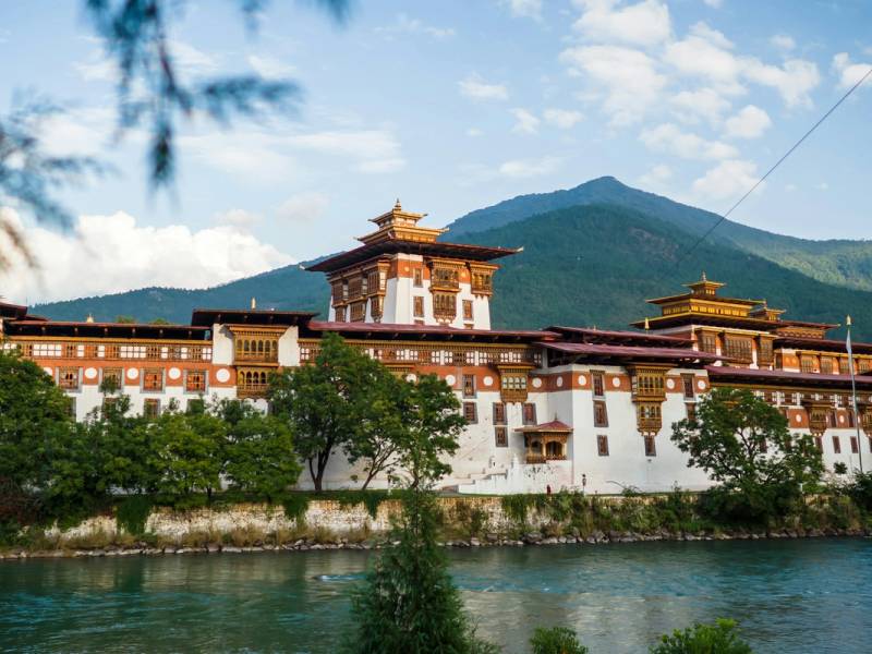
Dochu La
- Time needed
- 30 minutes to 1 hour; half a day with the Lungchutse walk
- Altitude
- 3,100 m
- Best time
- Clear winter mornings, roughly October–February
Highlights
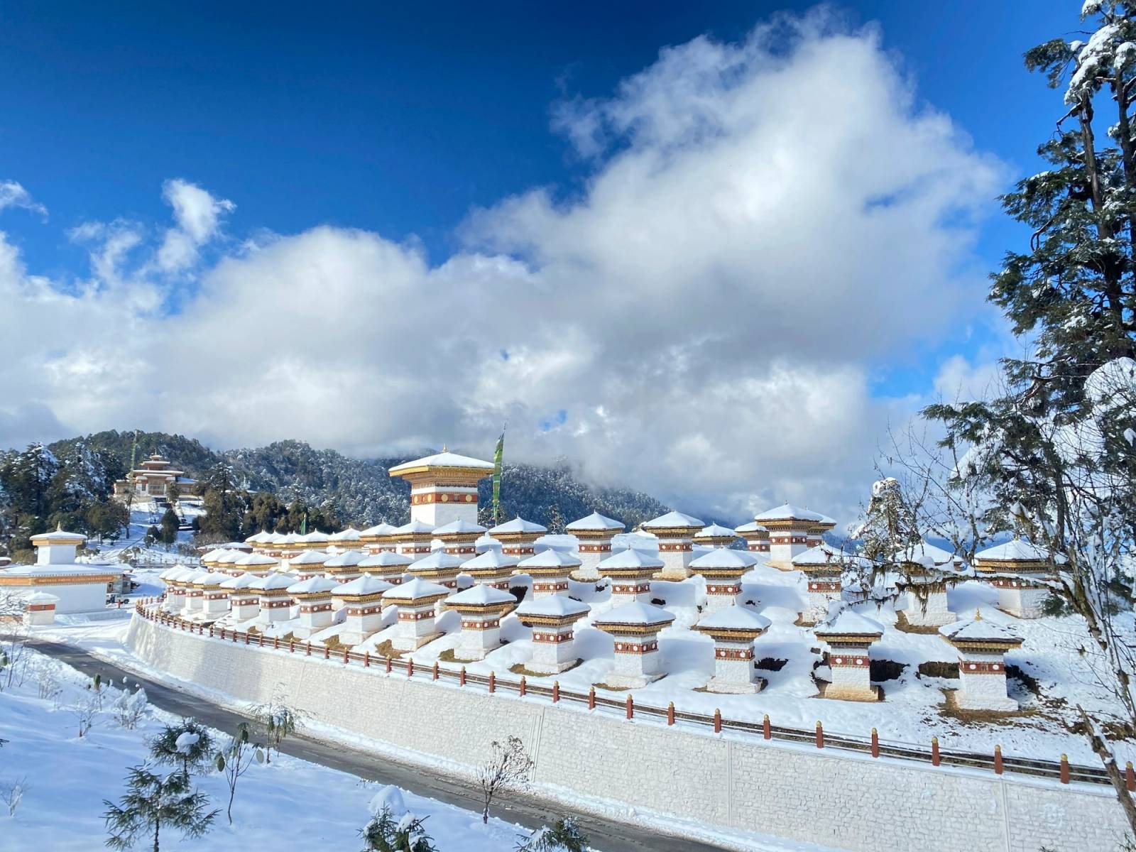
- 108 chortens against the Himalaya
- Gangkar Puensum, Bhutan's highest peak, on clear days
- A fixed-date festival every 13 December
A pass on the drive from Thimphu
Dochu La is the pass on the main road between Thimphu and Punakha, at about 3,100 m. You don’t make a separate trip to it. Almost everyone driving to Punakha crosses it about 45 minutes to an hour out of Thimphu and stops here, to stretch, look for the mountains and walk among the chortens. From the pass the road drops almost 1,900 m through forest to the warm Punakha valley.
The 108 Druk Wangyal chortens
The 108 chortens on the hillock in the middle of the pass were built under the patronage of Queen Mother Ashi Dorji Wangmo Wangchuck. They honour the Bhutanese soldiers who died in December 2003, when the army, led by the Fourth King, Jigme Singye Wangchuck, drove Indian insurgent groups out of some 30 camps they had set up inside Bhutan. The chortens were finished and consecrated in June 2004.
They are known as the Druk Wangyal chortens, from the words for the victory of the Thunder Dragon. Each one is white with a red band, in the style called khangzang, with a gold finial on top. They are set in three tiers around the hillock:
| Tier | Chortens |
|---|---|
| Lowest | 45 |
| Middle | 36 |
| Top | 27 |
The number is not an accident. 108 is a sacred number in Buddhism, the same as the count of beads on a prayer rosary. Walk around the chortens clockwise, as you would around any chorten, and take the paths between the tiers rather than climbing on the walls.
Druk Wangyal Lhakhang
Beside the chortens stands the Druk Wangyal Lhakhang, the temple of the victory of the Thunder Dragon, finished in 2008. It was also built by the Queen Mother, in honour of the Fourth King and the armed forces, and completed in the year Bhutan marked a hundred years of monarchy. The design mixes traditional Bhutanese architecture with contemporary touches, which makes it a good contrast to the old dzongs you will see further on. The usual temple rules apply inside: hats off, no photos.
The mountain view
On a clear day the pass looks out over a long line of the eastern Himalaya. Among the peaks are Masanggang (7,194 m) and Gangkar Puensum (7,570 m), Bhutan’s highest mountain and one of the highest in the world never to have been climbed. Your guide will point out which is which.
The view is best on clear winter mornings, roughly October to February. Cloud tends to build as the day warms, and during the monsoon, from about June to September, you may see nothing but mist and wet prayer flags. That is still worth the stop. On a misty day the chortens appearing and disappearing in the cloud are a sight of their own.
The December festival
On 13 December every year the Druk Wangyal Tshechu is held in the open ground at the pass. The Queen Mother started it in 2011 to commemorate the 2003 victory and honour the Fourth King. Because the date never moves, it is easy to plan a winter trip around it. Our festival calendar lists it with the others, and our guide to tshechus explains what happens at one.
Walks from the pass
- Lungchutse Lhakhang: a trail climbs from the pass through hemlock, pine and rhododendron forest to the Lungchutse temple at about 3,560 m. It is about 4 km each way; allow half a day for the round trip. The effort is moderate, mostly because of the altitude, and on a clear day the view from the top is wider than from the pass.
- Royal Botanical Park, Lamperi: the pass sits within this protected area of about 47 km², with forest running from about 2,100 to 3,750 m. Red pandas live here, and the botanical garden grows 46 kinds of rhododendron, which flower from around March.
Our mountains and trekking guide covers longer walks.
Visiting
- Time: 30 minutes to an hour for the chortens and the view; half a day if you add the Lungchutse walk.
- Warm clothes: at 3,100 m the pass is much colder than Thimphu or Punakha, often windy, and snow is possible in winter. Bring a warm layer even if you are dressed for the valley. Our packing checklist has the details.
- Dress for the lhakhang: covered shoulders and knees, and no hats inside. More in our cultural etiquette guide.
- Photos: fine around the chortens and of the view; not inside the temple.
Getting there
Take the road east out of Thimphu. The pass is about 45 minutes to an hour away, and from there the road winds down to Punakha in about another 1.5 to 2 hours. There is nothing to plan: your driver will stop here on the way to Punakha or on the way back. Our getting around Bhutan guide explains how road days work.
Tips from our guides
- Leave Thimphu early if you want the mountains. The clearest views are usually in the first hours of the day.
- If the peaks are hidden on the way out, try again on the return drive; the weather here changes fast.
- Carry the story down with you. The demoness that Drukpa Kunley subdued came from Dochu La, and the temple built where he trapped her, Chimi Lhakhang, is in the valley below, on the same road. Punakha Dzong is the next stop after that.
- The Thimphu district administration has a short page on Dochula (opens in a new tab) with the history of the chortens and the lhakhang.
Last reviewed 24 September 2026
More to see in Punakha
Punakha Dzong
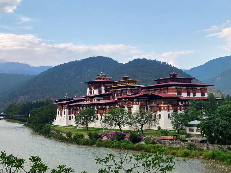
Built in 1637–38 where the Pho Chhu and Mo Chhu rivers meet, Punakha Dzong was the seat of Bhutan's government until 1955, and the first king was crowned here in 1907. It is still the winter home of the central monk body.
Chimi Lhakhang
A small temple on a hillock among the rice fields near Lobesa, built in 1499 on a site blessed by Drukpa Kunley, the Divine Madman. Couples hoping for a child come here for a blessing, and the walk in from Sopsokha takes about 20 minutes.
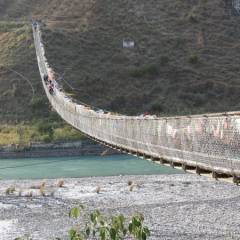
Punakha suspension bridge
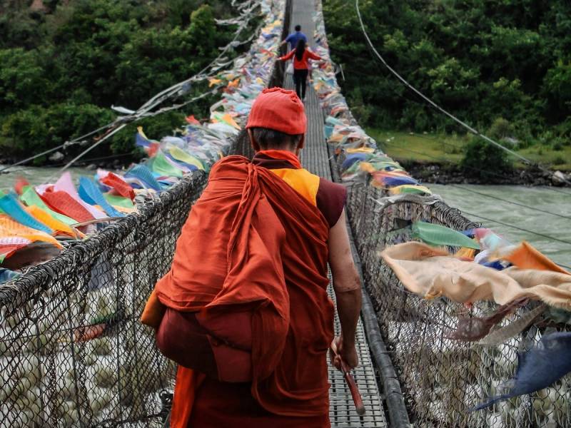
A long footbridge of steel cables and wooden planks across the Pho Chhu, a short walk from Punakha Dzong and one of the longest suspension bridges in Bhutan. It sways as you cross, it is hung with prayer flags, and it leads to the villages on the far bank.
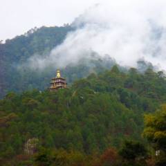
Khamsum Yulley Namgyal Chorten
A tiered chorten on a ridge above the Mo Chhu, built under Queen Mother Ashi Tshering Yangdon Wangchuck to ward off harmful forces and bring peace. It is about 30 minutes uphill from the footbridge at Yepaisa, through rice fields and pine, with wide views of the valley from the top.
Planning a trip that includes Dochu La?
Tell us when you would like to travel. We reply within 24 hours with a free day-by-day plan and a price.

Karma ChodenOperations manager, Bhutan Tour Itinerary
Or call +975 17 81 70 52info@bhutantouritinerary.com
Mon–Sat, 9am–6pm Bhutan time (GMT+6)