Bhutan weather by region
Punakha in January is shirtsleeve weather. Phobjikha, three hours up the road, freezes at night. Here is Bhutan valley by valley, with the numbers we plan around.
On this page
- Altitude, not latitude, decides the weather
- Paro and Thimphu: how cold the western valleys really get
- Punakha and Wangdue: the valleys that stay warm in winter
- Haa, Chele La and Phobjikha: where the snow actually falls
- Trongsa and Bumthang: the central highlands
- The east and the southern border towns
- Monsoon: what it does to roads, passes and Paro flights
- What to pack, valley by valley
- Tell us your month and we will tell you the weather
Bhutan is small but very steep, and one morning’s drive can move you 1,750 m up or down. Punakha sits at 1,242 m and Phobjikha at about 3,000 m, three hours apart, and they need different jackets in the same week.
Altitude, not latitude, decides the weather
Here are the towns you are most likely to sleep in or drive through, coldest month against warmest, in °C by day and night.
| Valley | Altitude | Coldest month (day / night) | Warmest month (day / night) |
|---|---|---|---|
| Gelephu | 221 m | Jan 22.3 / 13.2 | Aug 30.2 / 24.2 |
| Phuentsholing | 293 m | Jan 23.9 / 13.4 | May 32.3 / 21.7 |
| Punakha | 1,242 m | Jan 18.8 / 5.8 | Jul 30.7 / 20.8 |
| Wangdue | 1,273 m | Jan 19.3 / 5.0 | Jun 29.5 / 20.4 |
| Mongar | 1,600 m | Jan n/a / 5.8 | Aug 27.3 / n/a |
| Paro | 2,200 m | Jan 13.2 / −0.9 | Jul 25.0 / 16.1 |
| Thimphu | 2,320 m | Jan 14.8 / −2.2 | Jul 27.0 / 16.5 |
| Jakar (Bumthang) | 2,587 m | Jan 11.4 / −3.9 | Jul 22.7 / 14.4 |
| Phobjikha | about 3,000 m | Dec n/a / −4.8 | Aug 19.9 / n/a |
Where a cell reads n/a, the station record gives only one half of that pair.
Rain splits the country harder still. Thimphu collects 608.9 mm a year; Gelephu, on the southern border, collects 5,105.6 mm.
The Department of Tourism (opens in a new tab) works to four seasons: summer June to August, autumn September to November, winter December to February and spring March to May. Snow is common above 3,000 m, but it rarely snows in Thimphu or Paro, which is the opposite of what most people pack for. For how the seasons trade off against festival dates and crowds, read best time to visit Bhutan.
Paro and Thimphu: how cold the western valleys really get
Paro town and the airport sit at 2,200 m (7,200 ft). January averages 13.2°C by day and −0.9°C at night (56°F / 30°F), and the record low is −9.0°C. Rain totals 630.7 mm a year and falls mostly in July (161.2 mm), August (112.7 mm) and September (87.9 mm), so the valley is dry for roughly eight months.
Thimphu’s built-up area climbs from 2,248 m to 2,648 m, with the centre near 2,320 m. Those 120 m over Paro are why the capital bites after dark: January nights average −2.2°C against Paro’s −0.9°C, on a similar 608.9 mm of rain.
The daily swing catches winter guests out. Full sun, jacket off by eleven, then fifteen degrees gone the moment it drops behind the ridge.
Punakha and Wangdue: the valleys that stay warm in winter
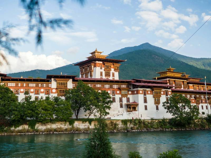
Punakha lies at 1,242 m, about three hours from Thimphu, and January nights there sit at 5.8°C instead of below zero. The Je Khenpo and the Central Monastic Body move down from Thimphu to Punakha Dzong every winter for the same reason. Wangdue Phodrang (1,273 m) is its near twin, and drier at 660.9 mm against Punakha’s 785.9 mm.
Summer is the trade-off. Both valleys turn hot and humid, Punakha at 30.7°C by day in July, so we start sightseeing early. In December and January we will often give you an extra night down here rather than another cold one in Thimphu.
Our cultural tours cross Dochula (3,100 m) on the way over. The Himalayan view from the pass is reliable between October and February. Outside that window it is usually fogged in and you see the 108 chortens rather than the mountains.
Haa, Chele La and Phobjikha: where the snow actually falls
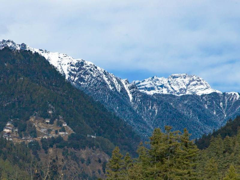
The Haa reference station sits at 2,720 m: annual mean 10.6°C, a January record low of −14.5°C, 883.9 mm of rain. Chele La, the pass between Paro and Haa, is 3,988 m and 35 km from Paro on the Bondey–Haa highway. It is the highest motorable pass in the country, and snow, ice and avalanche risk make it hazardous in winter, so we check it the morning we plan to cross.
Phobjikha (Gangtey), around 3,000 m, is the coldest place you are likely to sleep on a normal itinerary, and at 1,472 to 2,189 mm a year it is far wetter than Paro or Thimphu.
Guests come in the cold anyway. Black-necked cranes arrive in late October and leave in mid-February, and the Black-Necked Crane Festival is held in the Gangtey Gonpa courtyard on 11 November, confirmed for 11 November 2026 at the time of writing. See our festival tours, and bring a down jacket.
Trongsa and Bumthang: the central highlands
Trongsa, at 2,120 m, is milder than its reputation: mean daily maxima run from 15.2°C in January to 24.7°C in August. Bumthang is about 470 m higher and pays for it at night, with January minima of −3.9°C and 759.1 mm of rain a year.
The drive is half the story. Pele La (3,420 m) marks the boundary between western and central Bhutan and shows Jomolhari, 7,326 m, on a clear day. Wangdue to Trongsa is 129 km in about 5 hours and Trongsa to Bumthang 68 km in 3 hours, at a touring average near 45 km/h. Drukair (opens in a new tab) also flies Paro to Bathpalathang, 2,700 m on a 1,200 m runway. See driving distances and altitudes.
The east and the southern border towns
Mongar and Trashigang
Eastern Bhutan is wetter than the west at the same altitude, and its towns sit lower, so they feel milder. Mongar (1,600 m) has a dry-winter humid subtropical climate, an annual mean of 18.0°C and 914.4 mm of rain, with July wettest at 196.0 mm. Kanglung, in Trashigang district at 1,930 m, averages 9.2°C in January and 21.2°C in August on 1,167.7 mm.
The catch is the approach. Thrumshing La (3,780 m), 68 km east of Jakar, is the country’s second-highest road pass and the only overland link between central and eastern Bhutan. Heavy snow often closes it in winter; commercial and public vehicles are then barred and private vehicles cross at their own risk. Bumthang to Mongar is 198 km and 7 hours in good conditions, Mongar to Trashigang another 91 km and 3 hours. Yonphula has three Paro flights a week at the time of writing, and the Department of Tourism itself calls its summer weather unpredictable, given the altitude and micro-climate.
Gelephu and Phuentsholing
The border towns barely have a winter and they pay for it in rain. Phuentsholing (293 m) takes 3,953 mm a year, 962.6 mm of it in July alone. Gelephu (221 m) is wetter still at 5,105.6 mm, with August days at 30.2°C and nights averaging 24.2°C.
Monsoon: what it does to roads, passes and Paro flights
The monsoon runs roughly June to September and lands hardest in the south. It is not a national washout, but it does slow the roads. Bhutan recorded 343 highway blockages in a twelve-month period, 241 of them landslides, and the Trongsa–Gelephu highway is among the worst, with slips repeating at Aie, Boxcut, Ossey and Reotala. Most clear within hours to a day, so the real risk is a delay, not a cancelled trip. We keep summer driving days short for that reason. More in Bhutan in monsoon.
Paro’s airport is the other constraint, and rain is not the issue. At 2,235 m it operates day-VFR only: flights go in visual conditions between sunrise and sunset, with further restrictions on windy afternoons.
Fly out of Paro in the morning and leave a night’s slack before any onward international connection. It is the cheapest insurance on the trip. See getting to Bhutan.
What to pack, valley by valley
- Layers everywhere. A fifteen-degree swing between noon and night is normal at 2,200 m and above.
- A down jacket for Phobjikha, Bumthang and any trip between November and March. You will not need it in Punakha or the south.
- Sun protection year round. At 2,200 to 3,000 m the sun is stronger than the air temperature suggests.
- A rain shell from June to September, and for the east and south in any month.
- Light clothes for Punakha, Wangdue, Mongar, Gelephu and Phuentsholing, even in midwinter.
- Something smart for the dzongs. There is no mandatory dress code, but clothing that covers you from shoulders to knees is appreciated at religious sites.
Altitude itself is rarely a problem on a cultural route. The highest place you sleep is usually Phobjikha at about 3,000 m, and the passes are crossed in transit. Trekkers are a different case, covered in altitude and health and our trekking tours.
Tell us your month and we will tell you the weather
Send us the dates you can travel and we will say which valleys will be pleasant, which passes are a risk and how we would reorder the route. A January trip that sleeps in Punakha and sightsees in Thimphu is a different holiday from the same dates run the other way round.
Ask us about your dates, or start from 8 Days Glimpse of Bhutan and we will shape it around the weather you came for.